America’s Lost Highway – Illinois’ U.S. Highway 66 now available on Google Maps

200px-US_66_(CA).svg

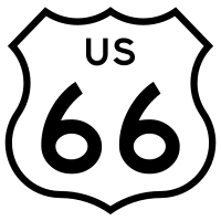
Before the creation of Interstate 55, U.S. Highway 66 was the most heavily traveled highway in Illinois.  It cuts diagonally across the State between the great populations centers of Chicago and St. Louis.  Along its course are the State Capital and multiple State institutions.

Illinois’ U.S. Highway 66 on Google Maps

More free guides available at Autotrails.net

Leave a Reply

Fill in your details below or click an icon to log in:

WordPress.com Logo

You are commenting using your WordPress.com account. Log Out /  Change )

Facebook photo

You are commenting using your Facebook account. Log Out /  Change )

Connecting to %s

This site uses Akismet to reduce spam. Learn how your comment data is processed.