In Oklahoma: A Guide to the Sooner State, on which this guide is based, the travel route of U.S. Highway 70 is indicated as turning south at the junction with U.S. 277 on D1990 Road.
US 70 crosses over a long bridge spanning a wide expanse of river-bed sand and a narrow stream to the TEXAS LINE, 268.5 m., at a point 2.5 miles northeast of Burkburnett, Texas (see Texas Guide).
This earlier route of U.S. Highway 70, 277, and 281 connected with Oklahoma Highway 36 at that highway’s current junction with E1990 Road, south of the present Kiowa Casino. That earlier route then continued to the present intersection of Oklahoma Highway 36 and Interstate Highway 44 (Exit 1). The current route of Interstate Highway 44 and U.S. Highways 277 and 281 south from Exit 1 to the Red River bridge follows the earlier route of U.S. 70 into Texas.
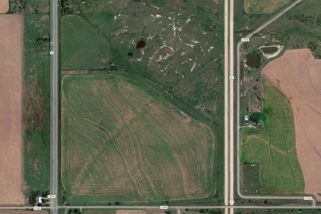
Today’s traveler can follow D1990 Road southwest from Randlett southwest to a point at the east side of Interstate Highway 44. However, that highway bisects the old route and the traveler turns south, parallel to the current expressway, to an intersection with E1990 Road, 0.7 miles east of Oklahoma Highway 36.
The aerial photo below clearly shows the earlier curved route of the highway beyond Interstate 44 to Oklahoma Highway 36.
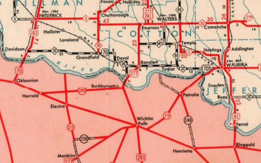
The portion of the Rand McNally map of Oklahoma (1927) below shows the earlier route of U.S. Highway 70.

This map was created prior to the designations of U.S. Highways 277 and 281, and predates the designation of Interstate 44 on the H.E. Bailey Turnpike by 55 years. On March 3, 1945, the route of U.S. Highway 70 from Randlett was realigned to follow Oklahoma Highway 32 west to Davidson, Oklahoma, before turning south with U.S. Highway 183 to Oklaunion, Texas. U.S. Highway 277 still followed the previous route to Burkburnett.